| Home > All By Location regional map > Braddock > Hall Station Bridge -- William Penn Highway | |||
|
|
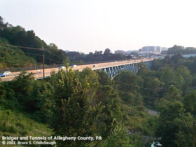
View southwest from Monroeville More detail photos OFFICIAL NAME: Hall Station Bridge OTHER DESIGNATION: William Penn Highway over Thompson Run brad601-9 LOCATION: Monroeville-Wilkins USGS 7.5" Topo Quad - UTM Coordinates: Braddock - Zone 17; 0601 4476 CARRIES: William Penn Highway [US22, SR2048]; 6 ft sidewalk to south BETWEEN: -- Monroeville Mall -- Penn Center East, Wilkins CROSSES: -- Union Railroad; Thompson Run (Turtle Creek tributary); Thompson Run Rd TYPE OF CONSTRUCTION / DESIGN: Steel spandrel-braced deck arch (Pratt) LENGTH OF MAIN SPAN: 349 ft est over railroad, 300ft est over Thompson Run Rd, with two 149.5 ft est counters, plus simple approach spans TOTAL LENGTH (including longest elevated ramp): 1,127 ft measured (1,252 ft) HEIGHT OF DECK: YEAR ERECTED / ENGINEER: 1942, 1957, PA Dept of Highways ADDITIONAL INFO: William Penn Highway (Business US22) is the fourth of five iterations of a major east-west route through Monroeville. The 1758 Forbes Road traces the northern border of Monroeville as Frankstown Rd. Built as a military road to Pittsburgh, parts were incorporated into the State Road as the main route from the east. Northern Pike once climbed into and out of the Thompson Run valley just north of Hall Station. An 1806 act authorized a new turnpike to be constructed, with commisioners in the various counties along its route. Dividing the routes into section made fundraising by stock subscription easier. An 1811 act authorized the commonwealth to provide $300,000 to the company which could raise $150,000 in stock. A competition developed between the southern route (which included the Greensburg Pike) and what would become the Northern Turnpike. The rivalry delayed the construction of both. In the early 1920s, the Pennsylvania Department of Highways built (Old) William Penn Highway as an improved two-lane highway which substantially followed the Northern Turnpike. After entering Allegheny County from the east, the new highway crossed Abers Creek and diverged from the old pike. Northern Pike begins a difficult climb to follow a ridge line; Old William Penn Highway takes a more northern route following older local roads on the water level route connecting one creek valley to another as it traverses Monroeville. Each of these earlier routes were bypassed but not altogether replaced by the construction of William Penn Highway in the early 1940s. Built as a three-lane highway and widened to five lanes in 1957, the new highway contributed to the massive suburban growth that caused Patton Township to transform into Monroeville. The truss has two ribs 36 feet apart with a third rib 18 feet to the south -- evidence of the widening of the bridge. Each sucessive east-west route was influenced to a lesser degree by the terrain. The first paths followed Indian trails on ridge lines to avoid stream crossings. As construction machinery improved and automobiles arrived, the geometry of the roadways tended to straighten and widen with cuts and fills. When the 1941 William Penn Highway reached the deep Thompson Run valley at Hall Station, the new road lept across the void with a 1,127 foot long high level bridge which made the former barrier insignificant. --- In addition to the toothed expansion joints at each end of the main truss, there are smaller joints at other locations on the deck. The simple spans at each approach are easily measured; but from the deck the truss is obscured and measuring the main span and side spans is not so simple. On the Wilkins approach, there are simple spans of 102 ft-2 in and 18 ft. On the Monroeville approach, there are simple spans of 18 ft and 83 ft-6 in. Between these simple spans, the main truss appears in an arching cantilever form with one main span and countering side spans. Beginning in Wilkins and measuring eastward, the joints are found at 303 ft, 140 ft, 265 ft, 218 ft-8 in, and 69 ft-10 in. As there are two main spans with cantilever counter spans, this indicates that some of the bearings are sliding bearings. Counting the number of panels of each section of the truss, and assuming each panel is of equal length, the span over the railroad measures 398 ft and that over Thomspon Run Rd is 300 ft, with a 149.5 ft counter span at each end. --- In the shadow of the Hall Station Bridge, the Union Railroad locomotive shop is part of a system including 65 miles of track and 200 miles of railyards -- all within eastern Allegheny County. The URR has its beginnings in 1896 as a part of a rail link from Lake Erie to the steel mills on the Monongahela River. The company arose from the union of five railroads between 1906 and 1915, and was the southern end of the Pittsburgh, Bessemer and Lake Erie Railroad. The B&LE was financed by Andrew Carnegie to supply his steel mills, bypassing the Pennsylvania Railroad, and allowing Carnegie to control transportation costs for raw materials. The URR follows the Thompson Run valley northward to join with the B&LE at North Bessemer yard. --- view page - Field Notes: Historic Crossings of Thompson Run in Monroeville view page - Field Notes: Northern Turnpike, Old & New William Penn Hwy and Parkway East at Churchill FIELD CHECKED: 30-Jul-2003 INFO SOURCES: field check Submit info or inquiry - share some facts or ask a question. Introduction -- Nearby Structures Page created: Last modified: 02-Aug-2003 |
View Larger Map 
| |
| copyright: © Bruce S. Cridlebaugh 1999-2008 All Rights Reserved | |||