| Home > All By Location regional map > Glassport > Allegheny County Airport Runway 10-28 over Lebanon Rd | ||||
|
|
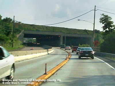
Southbound on Lebanon Rd; Union RR to right
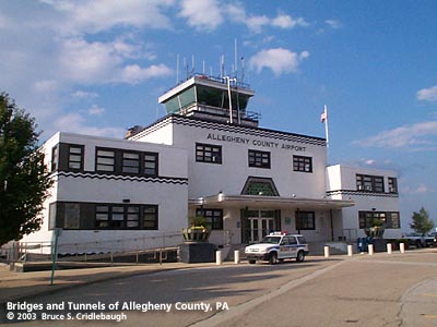
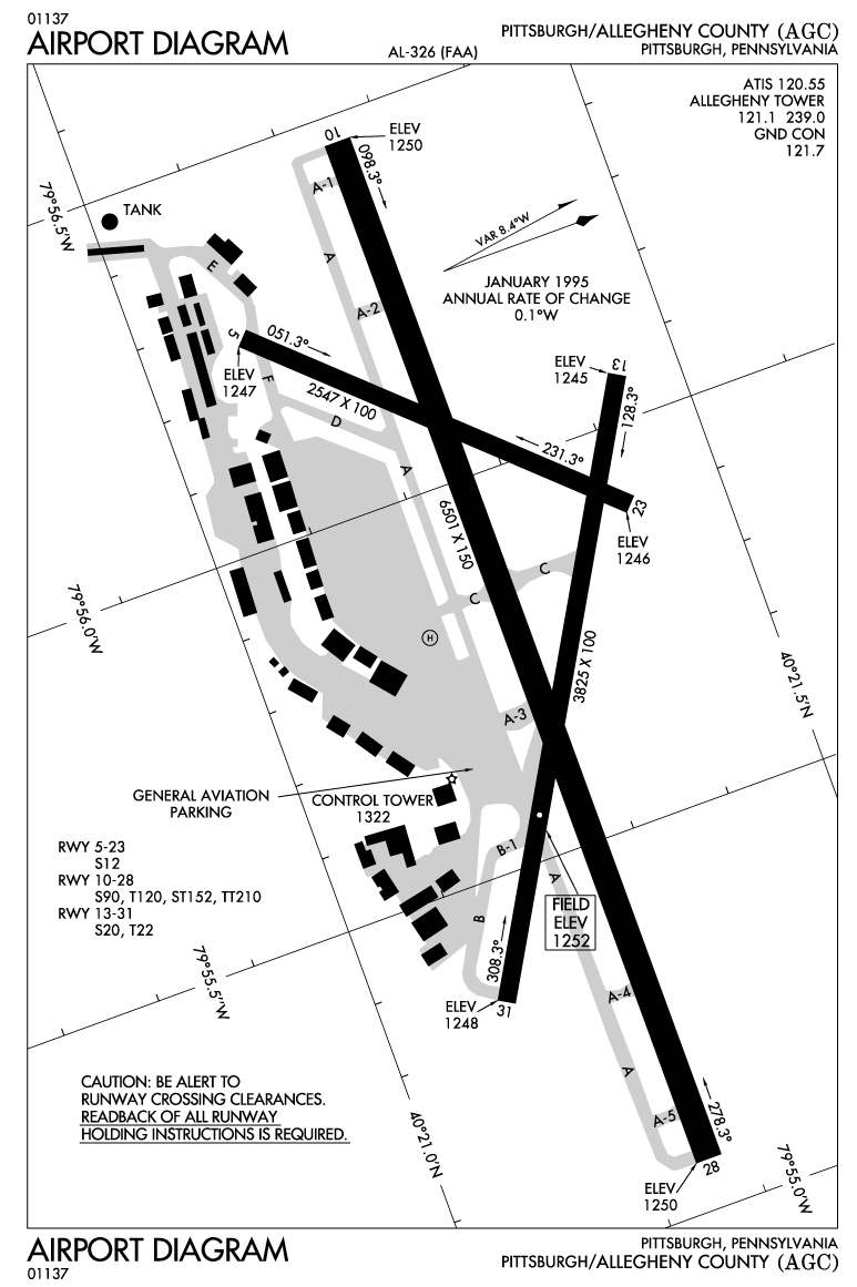
OFFICIAL NAME: Runway 10-28 OTHER DESIGNATION: Allegheny County Airport runway 10-28 over Lebanon Rd and Union RR glas590-4 LOCATION: West Mifflin USGS 7.5" Topo Quad - UTM Coordinates: Freeport - Zone 17; 0607 4500 CARRIES: Runway 10-28 BETWEEN: -- CROSSES: -- Lebanon Rd [PA885]; Union Railroad TYPE OF CONSTRUCTION / DESIGN: Concrete box beam LENGTH OF MAIN SPAN: TOTAL LENGTH (including longest elevated ramp): HEIGHT OF DECK: YEAR ERECTED / ENGINEER: Airport opened 1931 Runway extended 1969, Allegheny County ADDITIONAL INFO: There are varying accounts of which was the first commercial airfield in or near Pittsburgh. One contender is Mayer Field in Bridgeville opened in 1919 by Casper P. Mayer. More often mention is made of Rodgers Field, adjacent to Fox Chapel Golf Club. This field was named for Calbraith Perry Rodgers, who, in 1911, was the first to cross the United States by airplane -- flying a Wright EX biplane. Rodgers Field opened in 1925, but was unable to handle increasing traffic. A 43-acre site above Dravosburg had been being used for flying exhibitions. With the addition of a small hangar and machine shop, Pittsburgh-McKeesport Airport was opened in 1925. It was rededicated as Bettis Field in November, 1926, in honor of Pulitzer Prize winner Lieutenant Cyrus Bettis who had been fatally injured in a crash the previous year. Air mail service was added in 1927. The site is now the Bettis Laboratory, a joint Navy-DOE program responsible for the research, design, construction, operation, and maintenance of U.S. nuclear-powered warships. At a particularly busy time for public works projects, a $43,680,000 "People's Bond Issue" was passed in 1928 to fund many bridge and road projects, a new county office building, and $1.5 million for a County Airport. Construction of the Allegheny County Airport began in 1928. The new county-owned facility was the first airport to have hard-surfaced runways. It opened September 11, 1931. Stanley L. Roush was the architect for the 1931 terminal building. He is also noted as the architect for many of the bridges built by the city and county. Nearby roads, such as Lebanon Church and Curry Hollow Roads and the Pleasant Hills Cloverleaf at PA51, were built to help connect the airport with Pittsburgh, South Park and the southern suburbs. But the county airport site offered limited expansion possibilities. With the coming of the jet age in aviation, a new location was sought. In 1952, Allegheny County opened what was then the largest passenger terminal at the Greater Pittsburgh Airport in Moon Township, a more rural area in the western part of the county. As built in 1931, the Allegheny County Airport included three runways: 5-23 = 2547 ft; 13-31 = 3825 ft; and the main runway, 10-28, which was approximately 5,500 ft long when first opened. A March 24, 1965, Post-Gazette article reported plans for a 2,000 foot expansion of the main runway which would carry it across Route 885 and the Union Railroad. A later article revised the extension to 1,500 feet. Construction began in April, 1969. It was thought with the opening of the new airport in 1952 that the Allegheny County Airport (AGC) would fade into obscurity. Though all of the commercial traffic moved, private and corporate traffic sustained the smaller facility. It is the fifth busiest airport in Pennsylvania with 139,00 landings and take-offs per year. While more hangars and facilities have been added to the 500-acre AGC, the terminal at Greater Pittsburgh Airport was replaced entirely in 1992. FIELD CHECKED: 3-Aug-2003 INFO SOURCES: field check; PA Dept, Carnegie Library of Pittsburgh; Historic American Engineering Record, "West End-North Side Bridge, PA-96;" Robert B. Van Atta, Tribune-Review, April, 13, 2003; Richard David Wissolik, "Airport Early Days;" National Air and Space Museum; www.pitairport.com Submit info or inquiry - share some facts or ask a question. Introduction -- Nearby Structures Page created: Last modified: 12-Aug-2003 |
View Larger Map 
| ||
| copyright: © Bruce S. Cridlebaugh 1999-2008 All Rights Reserved | ||||