| Home > All By Location regional map > Pittsbugh East > Chestnut St over Parkway East | ||||
|
|
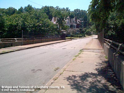
View north from Aberdeen St
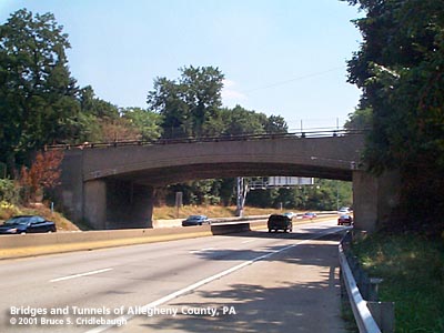
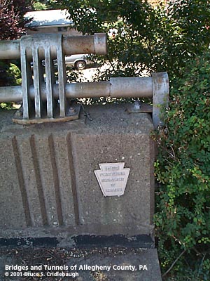
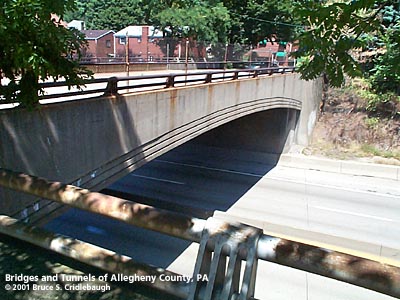
OFFICIAL NAME: OTHER DESIGNATION: Chestnut St over Parkway East LOCATION: Edgewood USGS 7.5" Topo Quad - UTM Coordinates: Pittsburgh East - Zone 17; 0594 4475 CARRIES: -- Chestnut St BETWEEN: -- Elm St -- Aberdeen St CROSSES: -- Parkway East [I-376, US22, US30], four lanes divided TYPE OF CONSTRUCTION / DESIGN: reinforced concrete rigid frame segmental arch LENGTH OF MAIN SPAN: 74 ft est TOTAL LENGTH (including longest elevated ramp): 74 ft est HEIGHT OF DECK: YEAR ERECTED / ENGINEER: 1950, PA Dept of Highways ADDITIONAL INFO: The John F. Casey Company of Pittsburgh was responsible for the construction of the structures in Edgewood Borough which carry the railroad and Edgewood Av over the Parkway East 1000 feet west of Chestnut St. That project began November, 1947, and was completed in August, 1949. The highway grading in this section was not started until January, 1950, apparently needing to await the completion of the complex of structures and the Brinton Av bridge. Although the PA DOH report does not offer specifics about the Chestnut St bridge, but the keystone embedded in the western parapet states the date as 1950. Chestnut St crosses above the Parkway East on a reinforced concrete rigid frame segmental arch span. In 1981, the Parkway was rebuilt in this area and the lanes were excavated and regraded. The vertical curve below Chestnut St was altered to provide over a foot greater clearance for Parkway traffic. The short span of the bridges carrying Laurel St, the railroad, Edgewood Av and Chestnut St restrict any opportunity to widen the highway. Although the Squirrel Hill Tunnel receives the blame for outbound traffic tieups, the eastbound entrances from Swissvale (one extremely short, the other including a 5 percent uphill grade) are forced to merge immediately prior to passing under Laurel St. The Parkway passes the Braddock Av interchange at a 2.7 to 2.9 percent uphill grade; the grade increases to 5 percent after passing Chestnut St. At that point a climbing lane was built in lieu of the standard shoulder for emergency use. But the impact to traffic has already been made before the climbing lane is reached. If not for the expense and complication of replacing the many structures crossing the Parkway in Edgewood, the highway could be made three lanes outbound. The 1904 G. M. Hopkins plat map shows the NY&CGC Co (New York & Cleveland Gas Coal Co.) railroad operating a spur line from the PRR mainline along what would become the Parkway route to the east. This line extended to the location of the Brinton Rd bridge. Another plate from the map book shows the spur served the Enterprise Brick and Stone Co, which included an incline plane from Chalmers St in Swissvale and a mine (also with an incline plane) which pierced the hillside to the north of the current Parkway route. FIELD CHECKED: 02-Aug-2001 INFO SOURCES: field check; 1953 PA Dept of Highway report; Port Authority of Allegheny County Submit info or inquiry - share some facts or ask a question. Introduction -- Nearby Structures Page created: Last modified: 07-Aug-2001 |
View Larger Map View Larger Map View Larger Map 
| ||
| copyright: © Bruce S. Cridlebaugh 1999-2008 All Rights Reserved | ||||